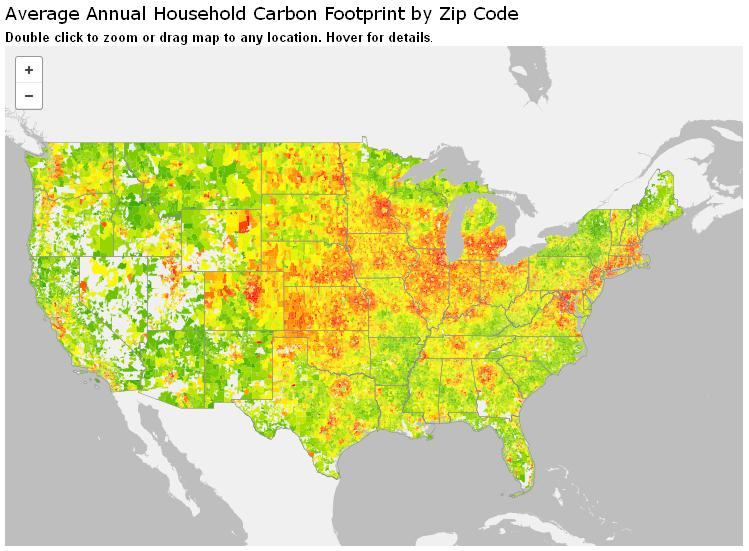
Check out this interactive carbon footprint map from the CoolClimate Calculator. The map shows average annual household carbon footprint by zipcode. Find out how you compare to local averages and create a personalized climate action plan for you or your community.
Click
here to go to the map. Double click to zoom or drag map to any location. Hover for details.
0 comments:
Post a Comment